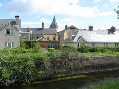
Saturday, June 27, 2009

The Rocky Road to Dublin

Okay, so, from Tramore we drove the next day northwest to the town of Cashel - home of the famous Rock of Cashel. The Rock of Cashel is a hill located in the town of Cashel in County Tipperary. It was originally the stronghold of the kings of Munster (the southwest quarter of Ireland - more or less). In the middle ages the Rock was given to the Church and from then on, became the site of various religious structures. It was largely ruined in the 1600's by Cromwell's jolly crew. For more details, see the Wikipedia article: http://en.wikipedia.org/wiki/Rock_of_Cashel.

This sign was there in case you didn't know what the big damn rock in front of you was

The Rock of Cashel with the ruins atop it

The car park for the RoC was, of course, at the bottom of the hill. After a long, steep climb up a long steep path, we four old geezers actually made it to the top. Frankly, it was a real stress test. I was expecting a cardiologist with an EKG machine to be waiting for us. Alas, there was just a place where you paid money to see the ruins.

The view from the top of the RoC - what do you see? More ruins.

The cathedral on the Rock. It's pretty much intact except for the roof and the windows.

Inside Cormac's Chapel


We went inside a smaller church on the RoC called Cormac's Chapel. It has a stone roof and stayed pretty much intact during all the Cromwell nonsense. However, if you notice the little bits of color on the vaulted ceiling in the above picture, these are the remains of what are believed to have been some amazing frescoes - kind of an Irish Sistine Chapel. Unfortunately, the damp Irish climate pretty much destroyed them, and these bits of color are all that's left.


This was in the indoor exhibit at the RoC. I think it's supposed to be what's left of a cross set up by St. Patrick - patron saint of Ireland and, in the U.S., of green beer.


After having duly noted the Rock of Cashel, we set off for dear old Dublin (well, actually Rathcoole, a suburb of Dublin where we were staying at a B&B). Along the way, we traveled on some good sized chunks of divided, limited access highway - basically Interstates, except they are called Motorways in Ireland and the U.K. None of these existed when I drove around Ireland thirty years ago - I suppose they are a result of the recent prosperity and E.U. membership.

Well, in the fullness of time (a couple of hours or so) we arrived at our B&B in Rathcoole. Since it was still some time before noon, our rooms were not ready, but the lady who owned the place kindly let us leave our luggage in her sun room so we could rush off to Dublin and explore.


Our B&B in Rathcoole

Our original plan in staying in Rathcoole was to take a bus into Dublin - we most definitely did not want to drive in Dublin traffic. The B&B owner told us that we also had the choice of a tram line which had a station a few miles away and would take us into the heart of Dublin. After a bit of doing - the lady's directions were rather vague and the tram station was too new to show up on the rather outdated GPS we had- we found the station, parked in its extensive lot and took the tram (what we would call a trolley car or light rail system in the U.S.) into Dublin.


The Dublin light rail which is officially called the "Luas" (Irish for "speed") system. It began operating in 2004; there are plans to expand it. This picture is at the station where we boarded: "The Red Cow Station". In downtown Dublin the tracks are in the street like an old-time trolley.


After a pleasant, 35-minute ride, the tram deposited us at Abbey Street by the corner of O'Connell: pretty much the heart of Dublin. From there it was off to see the sights.

Roz cozies up to James Joyce - Don't tell Nora!

On our first of two days in Dublin, we opted to take one of the on/off tour busses. You buy a one day ticket good for as many trips on the guided tour bus as you want, and you can get on and off their scheduled stops (which are usually near tourist sites) as often as you please. I think that I will continue with our Dublin adventures in the next post. For now I will leave you with a short video that Michelle shot of O'Connell Street in the heart of the city. It gives some idea of the vibrant busy life of the place:


.


Next: Dublin's Fair City, Molly Malone, and Guinness

Sunday, June 21, 2009

Stoned at Blarney

The next morning, we got up and had our adequate if ordinary B&B breakfast and set off again. Our next stop was the lovely harbor town of Kinsale. Parking was a bit of a problem, but we managed to find a spot along the harbor sea wall. With Abe's help, I was able to get the car into the spot without any damage to it or anything else.

Kinsale harbor - where we parked is across the harbor from this viewpoint.

We wandered around the streets for a while. Kinsale is a very pretty town with some interesting shops.


A street in Kinsale

After a bit, we stopped for lunch in a small cafe. Forget what we had, but I'm sure it was good. I would have remembered if it was terrible. After lunch, we set out for Blarney.

Blarney Castle is a fifteenth-century fortification which was built on the site of earlier castles. It is located a short distance west of Cork City. The castle is basically a square tower with some outer walls - not too different from Bunratty Castle. The main difference is that Bunratty has been restored while Blarney is still mostly in ruins. Also, there's the stone.

This sign purported to give the origin of the term "blarney" as referring to smooth talk, flattery and just plain B.S.

Now, yes, the stone. The "Blarney Stone" is located in an outside portion of the castle battlements high atop the castle walls. Why it is there and how it got there is anyone's guess. What it is, is also up for grabs. It has been claimed as being everything from a chunk of the Wailing Wall to the stone upon which the King of Ireland was crowned. I rather suspect that the stone and the legend of kissing conferring eloquence upon the kisser is, well, blarney.

Nevertheless, we all dutifully trooped up the steps to the battlements and stood in line to kiss the stone. One is held on to by a strapping Irish gentleman while literally bending over backward to kiss the rock.


Roz kisses the stone


I don't know if we all became more eloquent or not, but it makes a good story.


Blarney Castle - the stone is high up on the left

The view from the castle battlements

There was also a manor house near the castle. Presumably it was built after things got civilized enough to preclude the need for fortifications. We did not take the tour since we had already seen Muckross House which is probably the finest manor house available for touring in Ireland.

Blarney House

From Blarney, we took off for our next B&B located in the seaside resort of Tramore.

Tramore was a real seaside resort town with a wide sandy beach, an amusement park, arcades and a "boardwalk" (actually a cement "promenade").

The Tramore promenade with the amusement park to the right, the beach is on the left.

Tramore wasn't the pretty little poscard town that Kenmare and Kinsale were - not that it was ugly - but it was the kind of "real" place that real Irish families vacation and was interesting for that if nothing else.

After a good seafood dinner in a local pub recommended by our host at the B&B, we called it a day.

Next: The Rock of Cashel and Dublin City.

Wednesday, June 17, 2009

Ring Around A Kerry

The next morning after our medieval banquet and Irish malarkey evening, we arose bright and early for the splendid second "B" in B&B - an Irish B&B breakfast. Yeah, right. We had all entertained visions of baskets of steaming buttered scones, homebaked this and homemade that etc. etc. Well, the fact is, what you get served is decent but ordinary food such as an Irish family would eat themselves. Let's face it, most people don't stay up all night baking and so on. We Yanks are spoiled by U.S. B&B's where the draw is the fancy breakfast, otherwise you would stay in a Hampton Inn or something. In Ireland, I think the draw is the fact that a B&B is generally a cheaper alternative to a hotel. Which is fine. However it was a little disappointing.

At this B&B in Bunratty, we were given a choice of breakfasts. Abe, Roz, and I chose the scrambled eggs and smoked salmon. The eggs were OK, the salmon was great. Michelle ordered the pancakes. When they arrived, she determined they were the frozen, pop-in-the-toaster kind. I'm sure that this is what the lady B&B owner serves her own family and doesn't think twice. Did I mention that Michelle makes killer, from-scratch blueberry pancakes? Oh well. Also, Michelle did not like the Irish version of bacon - which I like. It's kind of similar to Canadian bacon, but in strips, very lean. Michelle thinks our fatty bacon is tastier. Pretty much all the breakfasts at B&B's were similar: decent enough, but very ordinary.

Anyhoo, from this point, we headed south into County Kerry and the sights around Killarney and the famous Ring of Kerry.

Our first stop was Killarney National Park, located just outside the town of Killarney. There we came across the semi-ruined Ross Castle on the shores of Lough Leane. The castle was once the stronghold of the O'Donoghues.


Ross Castle - Killarney National Park


Roz and I on the boat dock by Lough Leane - one of the famous lakes of Killarney


Our next stop was Muckross House: an 1843 Victorian Mansion designed and built by a Scottish architect. The family were wealthy and owned extensive property in the Killarney area. In 1932 they donated the estate to the Irish government and it formed the nucleus of the national park. We toured the house, which is decorated with period funiture and art. It was pretty amazing.

Muckross House - quite the little cottage


Another view- showing the porte-cochere or coach entrance


The Muckross House was also surrounded by some killer gardens. In Ireland's rainy, fairly mild climate, gardens are kind of a national pastime.


A view of the gardens and lawns


A sort of rock garden was part of the display


Finally, a close-up of some amazing rhododendrons in the gardens


After all too short a time at Muckross and Killarney National Park, it was time to hurry off to our next must-see: The Ring of Kerry. What's that? Well, in County Kerry, just to the south west of Killarney, there is a peninsula which is pretty much required on the tourist circuit. I'll let Wikipedia describe it: "The Ring of Kerry (Irish: An Mhór Chuaird) is a tourist trail in County Kerry, south-western Ireland. The route covers the 170 km circular road (N70, N71 and R562), starting from Killarney, heading around the Iveragh Peninsula and passing through Kenmare, Sneem, Waterville, Cahersiveen and Killorglin."

The Wiki paragraph above describes a trip around the Ring in a clockwise direction. We took the trip in a counter-clockwise direction. We did this for a number of reasons. One was we wanted to end up at Kenmare at the end of the day (where our B&B for that night was) and the other being the very practical one that the road around the Ring has some spectacular (read: steep cliffs) ocean views. By going the direction we did, we were assured that in left-drive Ireland, we would hugging the inner, or mountain side of the road and not the side with the steep drop-off. We were glad we did. Actually, the guide books claim you should go clockwise since the big tour buses go counter-clockwise and you won't get stuck behind one. I'd rather get stuck behind one than meet one head on on those roads. As it was, I don't think we saw any tour buses on the whole Ring.

The Ring was quite spectacular, both in the general scenery and in the ocean views. But it was, at times, a slightly scary drive. On a scary scale of 1-10, I'd give this about a 6 with the Road to Hana in Hawaii being a 9 and the California coast highway north of San Francisco about a 7.5. Had we gone clockwise, it would have been more like a 7.


One of the Ring's spectacular ocean views - not sure why the greens came out so vivid in this shot


Another ocean view - this is more typical as it was a cloudy day


A hillside with farmhouses


Michelle, Roz and I at a lookout

About half-way through the Ring, we all started to get a bit hungry. Fortunately, at this point we were entering a town called Caherciveen. We picked a likely-looking pub pretty much at random, and were rewarded with a lunch of delicious fishcakes with a side of what the Irish call potato wedges and we would call steak fries. Carherciveen was an interesting-looking town and like many places in Eire, I wish we might have had more time to explore.


The main street of Caherciveen at night - a picture from the Web. Notice that even the main street of a town is fairly narrow.

We left Caherciveen and continued on our rollicking way along the cliffs and hills. Eventually, at about the three-quarter mark, we came to the town of Sneem. Hmm... Sneem, wasn't he one of the pirates in "Peter Pan"? We stopped at bakery here for some tartlets/pastries which hit the spot quite nicely.

We stopped at this bakery in Sneem

Finally, we made it to the end of our epic drive and pulled into our B&B in Kenmare. If the name of the town rings a bell, it is a street in downtown Manhattan. It seems the street was named by early 20th century politician "Big Jim" Sullivan for the town where his mother was born. Ah, the Irish are sentimental S.O.B.'s.

Henry Street, Kenmare

After checking in and freshening up, we piled back into the car and headed into Kenmare proper for some dinner and hopefully some music. We were not disappointed on either count. Kenmare and the village of Kinsale are currently competing for the unofficial title of "culinary capital of Ireland." Once upon a time that might have been something of a joke. It is anything but, these days. We chanced upon a place called "The Coachmans Townhouse" in the heart of Kenmare. We had an excellent dinner and got to hear two young musicians: the Connor brothers play.


The Coachmans Townhouse, Kenmare

The Connor brothers

These two young fellows played guitar and electric fiddle and performed some really wonderful, foot-tapping music and I have to say, it was one of the highlights of out trip.

Then, afterward, it was back to our B&B and rest up for the next days sortie.

Next: Kinsale and Blarney

Friday, June 12, 2009

Down on Galway Bay

When last we left our intrepid explorers, we were leaving the stony wastes of the Burren and heading to Galway City - famous for the bay of the same name. Galway is a university town, home to a major branch of the National University of Ireland and a large part of its population are students making it a young and lively town - even though it was founded in the Middle Ages.

Navigating the crowded streets of Galway in a car was something of a horror show since apparently the streets haven't been widened since the aforementioned Middle Ages (on one, so-called two-way street, I predictably sprung the left side mirror) but once we found a rare parking space, we set out on foot and found the charming city (the fourth largest in Ireland) well worth the trouble of threading our way through its traffic.

Galway Cathedral - built 1965. We parked near here.


After parking, we crossed the Salmon Weir Bridge back across the River Corrib and followed the lovely river walk for a time.

The River Corrib seen from the bridge near the cathedral. The structure upstream is the Salmon Weir which helps control the swift-flowing river. Note the brave soul fly fishing in the rapid current

Another, perhaps more prudent fisherman just across the river from the fellow in the last photo.

Michelle and Roz on the Corrib River Walk. We were afraid they were going to break into a River Dance.

One of these houses was the home of Nora Barnacle better known as Mrs. James Joyce.


A spillway on the River Corrib

After we walked along the river, we turned left into Galway proper. What should we come upon but a pizza parlor, "Pacino's" by name. Since it was about that time (i.e. lunch) we gave it a try. The individual pizzas they served were not bad at all. Of course the best pizza in the world can only be had in New Jersey, but this pie was quite acceptable. After lunch, we wandered throught the town a bit, but time was ticking on and we had to get going as we had to drive back across County Clare to our B&B reservation in Bunratty and the Bunratty Castle banquet. So back to the car park and off we went again.


Pacino's on the Bridge - Galway


A bistro we passed while walking through Galway City. "Potata" is an approximation of "potato" pronounced in an Irish brogue. The Irish do have a sense of humor


Our drive took us south, back toward Limerick City on the N18 to the town of Bunratty located between Shannon Airport and Limerick. This was our first B&B of the trip. It was owned by a nice young couple who were very welcoming and friendly and who were the parents of two of the cutest toddlers this side of Little Mark. The B&B was a fairly new house which had been modified with a whole separate wing added to accomodate the guest rooms.

After putting our bags in the room and relaxing for a while, it was time to head to Ye Olde Medieval Banquet at Bunratty Castle about ten minutes down the road.

Bunratty Castle - The castle was built in 1425 on the site of a number of previous fortifications. It was restored in 1958 to the appearance it had in 1619

We arrived at the castle along with numerous other tourists and were ushered into the castle's great hall where we were greeted with music and cups of mead. The great hall was decorated with tapestries and other authentic accoutrements of the 1500's.


A fiddler and harpist greet us in the great hall.


Our intrepid travelers quaff ye stronge drinke in front of a stained-glass window

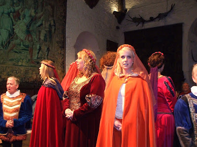
There was a master of ceremonies who was supposed to be some sort of major-domo of the castle who greeted us in the "name of the lord of the castle" and generally carried on with a lot of amusing Irish malarky. The overall effect was that of a Renaissance fair but with better actors. It was actually a lot of fun for what it was.

Some of the "singing wenches" who entertained us. The head varlet or whatever is the guy on the far left.

After a while we were led down one level to the banquet hall where we were all seated at a series of long trestle tables. More malarky followed with one tourist couple being designated the "lord and lady" for the evening. There was also a schtick where four Australian guys were sent to the "dungeon" for five minutes. And so on.

The food consisted of ribs and chicken eaten "medieval style" i.e. with a knife and the fingers. It was, in contrast to most of our Irish dinners, only mediocre. But one does not attend a thing like this for the gourmet dining. Actually, our fellow diners at our trestle table were four very interesting young people from Texas. They were three young women and a young man who worked for NASA. Three of them were engineers and the fourth was a financial programs analyst. They gave us a valuable tip concerning Waterford, where we were planning to visit the famous Waterford glass works later in the week. They told us that they had been to Wateford and the factory was closed. This saved us a trip to Waterford and freed up time for other sightseeing.

The entertainment continued during the banquet. The two people in the front center of the picture are two of the group who worked at NASA.

Michelle and I at the banquet. The people behind us were a group of Irish women who were having a bachelorette dinner for one of their girlfriends.

Eventually, the banquet wound down and it was back to our B&B.

Next: B&B breakfasts and onward to the Ring of Kerry.

Saturday, June 6, 2009

Who is Cliff Moher?

The morning of our second day in Eire, we woke up bright and early, our zombie-like state from the previous days lack of sleep pretty much erased by a good eight to ten hours in a comfortable bed. The Strand Hotel put on a nice buffet breakfast the price of which was included with our room, so we set out well fortified for the day's wanderings.

Our first stop was to be the fabled Cliffs of Moher in County Clare. They are located to the east of Limerick City. With a firm grip on the wheel, the help of the Bitch in the Box, and a lot of luck, we made it across the country roads of Western Ireland to the famous cliffs. They were spectacular. I won't even try to describe them; I'll let the pictures we took do it better.

A view looking southwest. The next stop from here is America.

O'Brien's Tower - a nineteenth century observation tower. The cliffs reach their maximum height of 702 feet above the ocean just north of here.


The cliffs just below O'Brien's Tower with the Atlantic breaking at their base.


Abe had me pose for this; Michelle swore she didn't pay him to get rid of me.

In case one did not get the point, these grim cartoons were all over the place.

Finally, we saw this sign near the edge - the Irish suicide hotline. This sign tended to turn up in places where people might jump - by rivers, cliffs etc.

There was a visitors center at the site with the usual interpretive center, lunchroom, t-shirt shops etc. The non-usual part of the center was the fact that it was mostly underground, set into the grass-covered rolling hills which lead up to the cliffs. This design minimizes the visual and ecological impact of the center and impressed me as very smart planning.

A portion of the visitor's center - it was all set into the hillside like this.

Anyway, the cliffs are one of Ireland's top tourist destinations and are listed in Roz's book of 1,000 places to see before you die. Of course, if you ignore the signs and get too close to the crumbly edge, you just might see the cliffs and die. Oh well.

Our next adventure of the day took us through a region in Western Clare called The Burren. In green and grassy Ireland, this is a region literally covered in grey stone. Once again, I'll let the pictures tell the story.


The stark, stony landscape of the Burren


A sign explains the geology of the region


The "limestone pavement" described in the sign above

The Burren was a stark, interesting landscape and a marked contrast from the usual lush green countryside of Ireland. Since the area consisted of stone, more stone, and not much beside stone, guess what was the favorite building material of the locals from prehistoric times onward? Yup, stone.
We saw evidence of this when we stopped at the Caherconnell stone ring fort in the middle of the Burren region. This was a dry stone circular wall with auxiliary walls and cattle pens which protected a local noble family and their livestock from around 400 AD until the end of the middle ages. In ancient Ireland, one's wealth and power were measured by the number of cattle and sheep one owned. Thus protection of the animal herds was nearly as important as protecting the people.

A portion of the main wall of the ring fort.

Some of the local "wealth" on the hoof.

To this day, cattle and sheep appear to be important to the local economy (even in modern high-tech Ireland). Nearly every available field seemed to support a herd of sheep or dairy/beef cattle.


Dry stone wall near the ring fort - note how the flat stones are laid vertically

It started raining pretty heavily while we were at the fort, so we beat a hasty retreat to our car and continued our trip through the Burren. Along the way we passed a prehistoric passage grave known as the Poulnabrone Dolmen. We did not want to stop in the rain so we just took a passing photo.

The Poulnabrone Dolmen circa 2000 BC

A ruined church in a small town in the Burren region. I thought it was interesting how they built a glass roof over the ruin to protect it from further deterioration.

After the Burren, our next stop was the university town of Galway and the famous Galway Bay. I was going to talk about Galway and our medieval banquet at Bunratty Castle in this post, but I think this one has been long-winded enough. So until next time. Slainte!